The Tulsa Port of Catoosa sits at the head of navigation of the McClellan-Kerr Arkansas River Navigation System — the northern terminus of a 445-mile waterway that carries barges from northeast Oklahoma to the Mississippi River and, from there, to the world, per the U.S. Army Corps of Engineers. Opened to navigation in 1971, the port complex grew into one of the largest inland river-port industrial parks in the United States: roughly 2,500 acres supporting more than 80 companies and about 4,000 jobs, per port authority records.
Tulsa is landlocked, and that is the port's whole reason for existing. Understanding how a barge harbor works 50 miles from the nearest natural waterway's commercial traffic explains a quiet but load-bearing piece of the regional economy.
How does the port physically work?
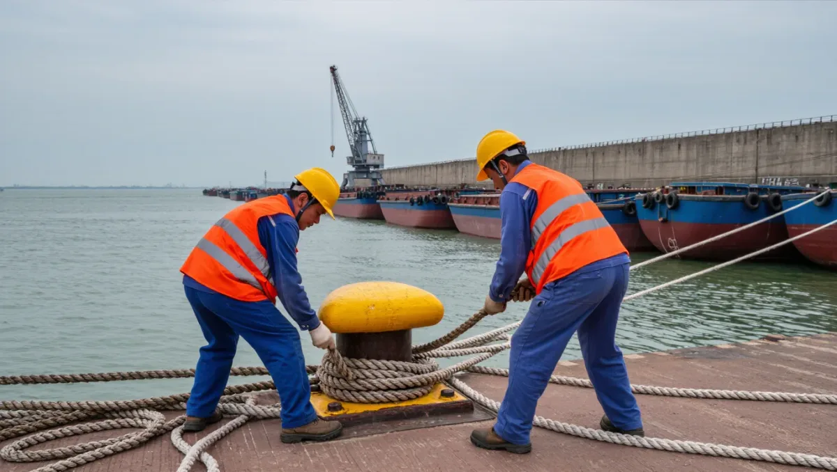
The port is a harbor carved off the river — a slack-water basin where barges moor in still water regardless of river current. Cargo moves three ways at once: barges dock at the harbor's wall, freight trains serve the industrial park's rail spurs, and trucks connect to area highways, making the port one of the region's genuine multimodal sites. shippers choose the port not because water is glamorous but because barge economics beat rail and truck on heavy, low-value freight — grain, fertilizer, steel, petroleum products, project cargo.
The public side is the Tulsa-Rogers County Port Authority, which owns the harbor infrastructure and leases land to private industry; the industrial park's tenants — food processors, manufacturers, and distributors among them — operate their own facilities on port ground.
What does the waterway connection mean?
The McClellan-Kerr system is the port's umbilical. A tow leaving Catoosa rides the river's locks and dams down through Oklahoma and Arkansas to the Mississippi at Napoleon — roughly 445 miles of engineered channel — and a barge shipment can reach Gulf ports or interchange to ocean vessels without touching a highway, per Corps reporting. The lock and dam chain, built and maintained by the federal government, is the capital asset that makes an Oklahoma harbor viable at all.
That dependence cuts both ways: lock maintenance schedules, drought-year channel depths, and federal funding cycles for the inland waterway system all transmit directly into Catoosa's tonnage. The port's best years track water years; its budgets track Washington's.
What does the port mean for the local economy?
Three layers. The direct one is employment: the port's several thousand jobs, many in manufacturing and processing that locate there specifically for water and rail access. The indirect one is the tenant mix's supply-chain pull — companies cluster near the port because their suppliers and customers do, an industrial-agglomeration effect the port has cultivated for five decades. The regional one is cost: barge access lowers freight costs for the bulk commodities Oklahoma agriculture and industry move, a saving distributed invisibly across farm margins and factory inputs.
The port also anchors the northeast Oklahoma corridor's case for continued federal waterway investment — every dollar of lock maintenance defends thousands of local jobs that exist only because the waterway does.
How does the port develop?
The port authority's model is patient: prepare ground, extend utilities and rail, attract a tenant, repeat. Land is the inventory, and the authority's announcements track site development as closely as tonnage — capacity expansion is how the port grows, since the harbor itself is built out. Cargo mix evolves with the regional economy: the traditional grain-and-fertilizer base has broadened as manufacturing tenants bring inbound components and outbound finished goods.
How does the port compare to its peers?
Among inland river ports, Catoosa’s distinction is integration: most barge terminals are cargo-only operations, while Tulsa’s is a harbor wrapped in a full industrial park with on-site manufacturing, processing, and distribution. That design — inherited from the port’s 1960s-era planning — means the facility’s value shows up less in tonnage rankings than in the payroll of companies that would not otherwise operate in northeast Oklahoma. Peer ports along the McClellan-Kerr system and the upper Mississippi compete for the same industrial prospects, and the port’s prepared sites and rail access are its standing pitch.
The comparison also clarifies what the port is not. It is not a container port — the river system moves bulk and project cargo, not consumer containers — and it is not a passenger facility. Its business is heavy things moved cheaply: the agricultural, energy, steel, and manufacturing flows that define Oklahoma’s trade profile. That profile is stable rather than spectacular, and the port’s five-decade record reflects it — steady growth punctuated by water years and commodity cycles rather than booms.
For economic developers, the port’s relevance has arguably risen with recent reshoring and supply-chain-resilience interest: manufacturers reconsidering inbound logistics look at multimodal sites with room to build, and Tulsa’s river assets enter conversations they were absent from a decade ago. The port’s land inventory — the same acreage its founders banked — is the asset that lets it answer.
The workforce question is the modern constraint: industrial employment at the port, as across manufacturing, faces the region’s shared hiring pressures, and the port’s growth scenarios increasingly run through training pipelines as much as through site development.
What to watch next
Watch the Corps' lock and dam maintenance program on the McClellan-Kerr system, the port authority's land development announcements, and annual tonnage reports — the three series that together tell whether Tulsa's riverborne economy is growing, holding, or being eroded by waterway underfunding. The port is 50 years into what its founders billed as a 200-year asset.